
Towards Geo-Aware Edge Models for Species Recognition
WACV 2027 · under review
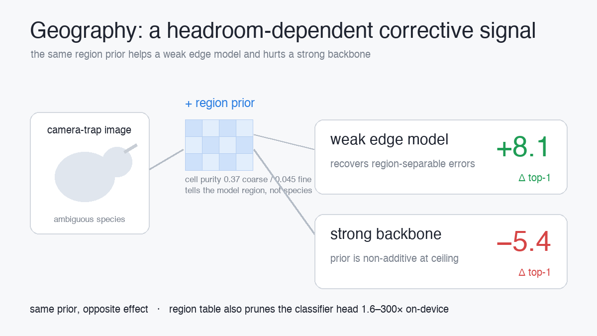
TL;DR — Geographic location is widely used as a prior for species recognition, but its value is governed by a single quantity: the fraction of errors that are geographically separable. That fraction is near-zero for a strong visual backbone (which already resolves most confusions from imagery) and large for a weak edge model — so the same per-region prior that hurts a near-ceiling classifier (−5.4 top-1) helps a weak on-device model by up to +8.1 top-1. Geography is a headroom-dependent corrective signal, not a universal accuracy booster.
The question
Automated species recognition increasingly runs on edge hardware — camera traps, field sensors, microcontrollers — where the image model must be small, quantized, and cheap. A natural way to help a weak on-device classifier is to add geographic context: species occupy restricted ranges, so knowing where a photo was taken should narrow what it might contain. Deployed systems like SpeciesNet already filter predictions to a supplied region as a practical heuristic. But this leaves a question open: when does geography improve accuracy, and when does it merely re-express what the image already determines?
What we found
Geography is a region-level signal, not a fine-grained cue. A location-only probe is strongly predictive of region but collapses at fine resolution (cell purity 0.37 coarse vs. 0.045 fine). It tells the model where it is, not what species is present.
Because it’s region-level, a strong backbone has already absorbed it. Multiplying a per-region prior into a near-ceiling classifier is non-additive and reduces accuracy (−5.4 top-1). The identical prior applied to a weak edge model recovers many region-separable errors (+8.1 top-1) — a headroom-governed sign flip we make measurable with an error-geography analysis, whose geo-recoverable ceiling rises ~10× as the backbone weakens.
The gains come from a discrete per-region table, not learned feature fusion — which matters for deployment.
Why it matters for on-device deployment
The same region structure a strong model has outgrown remains a deployment lever:
- Classifier-head pruning — the microcontroller-flash bottleneck — by 1.6–300× depending on region resolution.
- A lightweight location encoder distilled from the GeoTessera geographic foundation model, providing a known-location tie-breaker on-device at negligible cost (0.020 ms).
Both mechanisms rely on known location and do not generalize to unseen regions, unifying them as deployment uses of a shared geographic structure.
Takeaway
Our results reconcile the classical gains from geographic priors with their failure on modern backbones, and reframe location in species recognition as a headroom-dependent corrective signal rather than a universal accuracy boost — validated across three datasets spanning citizen-science and camera-trap settings, with on-device measurements.
Paper is under double-blind review — the manuscript is available on request. The preprint, code, and BibTeX will be linked here once the review period closes.